

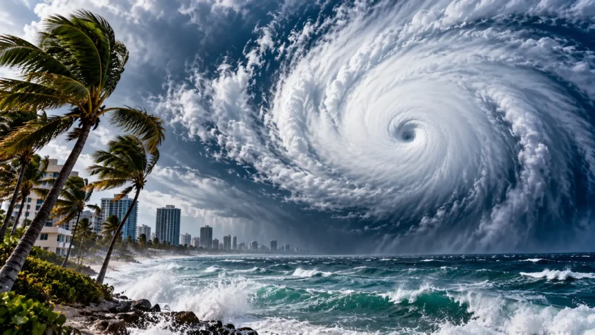
Hurricanes are among the most powerful weather systems on Earth, capable of producing destructive winds, heavy rainfall, dangerous storm surges, and widespread flooding. These enormous storms develop over warm ocean waters and can travel thousands of miles before weakening. Understanding what causes hurricanes helps explain why some tropical storms develop into dangerous weather events.
Hurricanes form when warm ocean water, moist air, low atmospheric pressure, and favorable wind conditions interact. As warm air rises and water vapor condenses, energy is released into the atmosphere. This energy supports powerful thunderstorms and rotating winds that can gradually organize into a large tropical cyclone.
However, not every tropical storm becomes a hurricane, and not every hurricane reaches extreme strength. Ocean temperatures, atmospheric moisture, wind shear, and other environmental conditions influence how these storms develop. This guide explains how hurricanes form, why they become so powerful, how scientists measure their intensity, and what causes them to weaken.
What Is a Hurricane?
A hurricane is a powerful tropical cyclone that forms over tropical or subtropical ocean waters. It consists of organized thunderstorms circulating around a low-pressure center. Hurricanes produce strong winds, intense rainfall, and potentially dangerous coastal conditions. They are classified as hurricanes when their maximum sustained winds reach at least 74 miles per hour.
The term hurricane is generally used for tropical cyclones in the North Atlantic and northeastern Pacific oceans. Similar storms in the northwestern Pacific are called typhoons, while the general term tropical cyclone is used in other regions. Despite their different names, these systems share similar physical characteristics and formation processes.
Hurricanes vary considerably in size, strength, and duration. Some develop slowly over several days, while others intensify rapidly when environmental conditions become favorable. Their effects depend on wind speed, rainfall, storm surge, movement, and the areas they encounter. Understanding their structure helps explain why these storms can become so destructive.
What Causes Hurricanes to Form?
Hurricanes begin when several atmospheric and oceanic conditions combine in a favorable environment. Warm ocean water supplies energy, while moist air supports the development of large thunderstorms. A preexisting weather disturbance provides an area where air can begin circulating. Low vertical wind shear helps the developing system remain organized.
As warm, humid air rises from the ocean surface, the atmospheric pressure below it can decrease. Surrounding air moves toward the lower-pressure region and begins rising as well. This process supports additional cloud formation and thunderstorm activity. When the circulation becomes organized, a tropical depression may eventually develop.
Earth’s rotation also influences the development of hurricane circulation through the Coriolis effect. This helps support large-scale rotation around the storm’s center. However, favorable environmental conditions do not guarantee that a hurricane will form. Many tropical disturbances weaken before becoming organized tropical cyclones.
Why Do Hurricanes Form Over Warm Ocean Water?
Warm ocean water is the primary energy source for hurricanes. Tropical cyclones generally develop most readily when sea surface temperatures reach approximately 26.5°C, or 80°F, with sufficiently warm water extending below the surface. These conditions support evaporation and the development of moist, unstable air.
When ocean water evaporates, it transfers moisture into the atmosphere. Warm, humid air rises within thunderstorms and eventually cools at higher altitudes. As water vapor condenses into cloud droplets, it releases stored heat energy. This process helps maintain rising air currents and supports the storm’s circulation.
Hurricanes can become stronger when warm water extends deeply beneath the ocean surface. Strong winds mix ocean water, sometimes bringing cooler water upward. If the deeper water remains relatively warm, the storm can continue receiving energy. This helps explain why ocean heat content matters alongside surface temperature.
How Do Hurricanes Develop Step by Step?
Hurricane development usually begins with a tropical disturbance, such as a tropical wave or cluster of thunderstorms. These weather systems contain areas of rising air and unsettled atmospheric conditions. When they move over sufficiently warm ocean water, evaporation and thunderstorm activity may increase. A circulation can gradually begin organizing around a low-pressure region.
If the system develops a closed surface circulation and sustained winds remain below tropical storm strength, meteorologists may classify it as a tropical depression. Continued organization and strengthening can produce a tropical storm. At this stage, sustained winds reach at least 39 miles per hour. Tropical storms receive names according to established naming procedures.
A tropical storm becomes a hurricane when its maximum sustained winds reach 74 miles per hour. Further strengthening may produce a major hurricane with even more powerful winds. However, storm development is not always a smooth progression. Changing atmospheric and oceanic conditions can cause temporary weakening, rapid strengthening, or complete dissipation.
How Does Warm Air Make Hurricanes Stronger?
Warm, moist air is essential for maintaining a hurricane’s energy cycle. Near the ocean surface, heat and moisture enter the lower atmosphere through exchanges between the water and the air. This humid air moves toward the storm’s center and rises within powerful thunderstorms. The process supports continuous atmospheric circulation.
As rising air cools, water vapor condenses into liquid droplets and releases latent heat. This additional heating makes the air within thunderstorms more buoyant, encouraging further upward movement. When conditions are favorable, this can help lower central pressure and strengthen the surrounding circulation. The process is an important part of hurricane intensification.
The storm continues drawing energy from warm ocean waters as long as environmental conditions support its structure. Stronger surface winds can increase the exchange of heat and moisture with the ocean. However, other factors, including wind shear and dry air, may interrupt this cycle. Hurricane strength depends on several interacting processes rather than heat alone.
Why Do Hurricanes Spin?
Hurricanes rotate partly because of the Coriolis effect, which results from Earth’s rotation. Moving air appears to curve relative to Earth’s rotating surface. This deflection helps support large-scale circulating weather systems. The direction of the rotation depends on the hemisphere in which the tropical cyclone develops.
In the Northern Hemisphere, hurricanes generally rotate counterclockwise around their low-pressure centers. In the Southern Hemisphere, tropical cyclones rotate clockwise. The circulation also depends on pressure differences and the movement of air toward the storm’s center. These forces interact to create the characteristic rotating wind pattern.
The Coriolis effect is relatively weak near the equator, which is why hurricanes rarely develop directly over it. Most tropical cyclones form several degrees north or south of the equator. A developing storm also needs a preexisting disturbance with sufficient circulation. Earth’s rotation helps organize that circulation but does not create hurricanes by itself.
What Role Does Low Air Pressure Play?
Low atmospheric pressure is one of the defining characteristics of hurricanes. Pressure refers to the force exerted by the atmosphere over a particular area. Inside a developing tropical cyclone, rising warm air and organized circulation are associated with relatively low surface pressure. Surrounding air flows toward this lower-pressure region.
As a storm intensifies, its central pressure often decreases. This can strengthen the pressure gradient between the storm’s center and surrounding areas. Stronger pressure gradients generally support faster winds. However, wind speed also depends on storm size, structure, and how pressure changes across different distances.
Meteorologists monitor central pressure because it provides valuable information about hurricane intensity. Very powerful hurricanes often have extremely low central pressures. Nevertheless, pressure alone does not fully describe the hazards associated with a storm. Wind distribution, storm surge, rainfall, and movement are also important when evaluating potential impacts.
How Do Thunderstorms Turn Into Hurricanes?
Thunderstorms provide much of the organized rising motion needed for hurricane development. Individual thunderstorms form when warm, moist air rises and cools, producing clouds and precipitation. Over tropical oceans, clusters of thunderstorms may develop around a preexisting disturbance. Their interaction can help establish a broader circulation.
For a hurricane to form, the thunderstorms must become organized around a developing center of low pressure. Sustained circulation allows moisture and energy to flow into the system. Favorable atmospheric conditions help maintain repeated thunderstorm development. Over time, this organization can transform an ordinary disturbance into a tropical cyclone.
Most thunderstorms never become hurricanes because the necessary environmental conditions are not always present. Strong wind shear, dry air, or insufficient ocean heat can disrupt their organization. Even favorable conditions do not guarantee development. Hurricane formation requires several processes to work together over an extended period.
What Is the Eye of a Hurricane?
The eye is the relatively calm central region found in many mature hurricanes. It is surrounded by the eyewall, where some of the storm’s strongest winds and most intense thunderstorms occur. The eye may contain lighter winds, fewer clouds, and temporarily improved visibility. Its appearance varies considerably between storms.
Air inside the eye generally sinks, contributing to relatively clearer conditions compared with the surrounding eyewall. However, the eye is not completely free from hazardous weather. Its size and organization can change during the hurricane’s development. Some weaker or less organized storms may not have a clearly defined eye.
The arrival of a hurricane’s eye can create a misleading period of calm in an affected area. Dangerous winds may return from a different direction as the opposite eyewall passes. People should remain in safe shelter until local authorities confirm that conditions are safe. A temporary reduction in wind does not mean the storm has ended.
Why Is the Eyewall So Dangerous?
The eyewall is a ring of powerful thunderstorms surrounding the eye of a mature hurricane. It commonly contains the storm’s strongest sustained surface winds and intense rainfall. Air rises rapidly within these thunderstorms, transporting heat and moisture upward. This activity plays an important role in maintaining the hurricane’s circulation.
When a hurricane intensifies, the eyewall may become more organized and support increasingly strong winds. Some intense hurricanes undergo eyewall replacement cycles, during which a new outer eyewall develops and gradually replaces the inner one. These structural changes can temporarily alter wind speeds and the area affected by damaging winds.
Eyewall conditions can be extremely hazardous because powerful winds may damage buildings, trees, and infrastructure. Heavy rainfall can also reduce visibility and contribute to flooding. The combination of wind and precipitation makes the region particularly dangerous. Hurricane safety guidance emphasizes staying sheltered throughout the entire storm.
What Is Wind Shear and How Does It Affect Hurricanes?
Wind shear refers to changes in wind speed or direction with height in the atmosphere. Tropical cyclones generally strengthen more easily when vertical wind shear is relatively low. This allows thunderstorms and atmospheric circulation to remain aligned around the storm’s center. Stronger shear can disrupt that organization.
When wind shear increases, it may tilt the storm’s vertical structure and move thunderstorms away from the center. This can interfere with the circulation and reduce the storm’s ability to intensify. Strong shear sometimes contributes to weakening. However, its effects depend on the storm’s existing structure and surrounding atmospheric conditions.
Low wind shear does not automatically guarantee rapid hurricane growth. Warm ocean water, atmospheric moisture, and other favorable conditions are also necessary. Meteorologists evaluate wind shear alongside these additional factors when forecasting intensity. Understanding shear helps explain why storms sometimes weaken even while traveling over warm water.
Why Do Some Hurricanes Become Extremely Powerful?
Some hurricanes become extremely powerful because they encounter an extended period of highly favorable environmental conditions. Deep warm ocean water provides substantial heat energy, while moist air supports continued thunderstorm activity. Low wind shear helps the storm maintain its organized structure. Together, these conditions can support substantial intensification.
A hurricane may also become stronger when its internal circulation becomes especially efficient. Organized thunderstorms around the eyewall help transport heat and moisture through the system. Falling central pressure can support increasing wind speeds. The interaction between the storm and the surrounding atmosphere determines how successfully these processes continue.
However, predicting exactly how strong a hurricane will become remains challenging. Small changes in ocean conditions, atmospheric moisture, and storm structure can influence intensification. A hurricane may strengthen rapidly under favorable circumstances or weaken unexpectedly when conditions deteriorate. This uncertainty is one reason meteorologists continuously monitor developing tropical cyclones.
What Is Rapid Intensification in Hurricanes?
Rapid intensification occurs when a tropical cyclone’s maximum sustained winds increase by at least 30 knots, approximately 35 miles per hour, within 24 hours. This represents a substantial strengthening over a relatively short period. Rapid intensification can make hurricane preparation more difficult when it occurs near populated coastal areas.
This process is often associated with very warm ocean water, substantial ocean heat content, low wind shear, and a favorable atmospheric environment. Internal storm organization also plays an important role. When these factors align, a tropical cyclone may gain strength more quickly than expected. Nevertheless, not every storm over warm water intensifies rapidly.
Forecasting rapid intensification has improved through satellite observations, aircraft measurements, ocean data, and computer models. However, accurately predicting its timing and magnitude remains difficult. Meteorologists continually examine atmospheric and oceanic conditions to identify increasing risks. Official forecasts and warnings remain important because hurricane intensity can change quickly.
How Are Hurricanes Classified by Strength?
Hurricanes are classified using the Saffir-Simpson Hurricane Wind Scale, which groups storms into five categories according to maximum sustained wind speed. Category 1 represents the lowest hurricane wind range, while Category 5 represents the highest. The scale provides a standardized way to communicate potential wind-related damage.
| Category | Sustained Wind Speed |
|---|---|
| Category 1 | 74–95 mph |
| Category 2 | 96–110 mph |
| Category 3 | 111–129 mph |
| Category 4 | 130–156 mph |
| Category 5 | 157 mph or higher |
Category 3, 4, and 5 hurricanes are considered major hurricanes because of their potential for substantial wind damage. However, the category scale does not measure rainfall, storm surge, or flooding. Lower-category hurricanes can still produce life-threatening conditions. Travelers and residents should evaluate all official hazard warnings rather than focusing only on category numbers.
How Do Hurricanes Cause Storm Surges?
Storm surge is an abnormal rise in seawater above the normally predicted astronomical tide, primarily caused by a storm’s winds pushing water toward the coast. Hurricanes can generate significant storm surge because their strong winds act across large areas of ocean. Coastal geography also influences how high the water rises.
Shallow coastal waters and certain shoreline shapes can increase storm surge impacts. The storm’s size, wind field, forward speed, and approach angle also matter. A large hurricane can produce dangerous coastal flooding even if its maximum sustained winds are lower than those of a smaller, more intense storm.
Storm surge is one of the most dangerous hurricane hazards because it can inundate coastal communities and make roads impassable. Floodwaters may also carry debris and create additional risks. Residents should follow evacuation instructions issued by local authorities. The hurricane category alone cannot determine how severe coastal flooding may become.
Why Do Hurricanes Produce So Much Rain?
Hurricanes produce heavy rainfall because they transport enormous amounts of moisture from warm ocean surfaces into the atmosphere. This moisture rises within thunderstorms and condenses into cloud droplets. The resulting precipitation may occur across extensive areas of the storm. Rainbands can continue developing as moist air enters the circulation.
The amount of rainfall depends on several factors, including atmospheric moisture, storm size, movement speed, and local geography. Slow-moving hurricanes can produce particularly high rainfall totals because precipitation continues affecting the same areas. Mountainous terrain may also enhance rainfall as moist air is forced upward.
Heavy rainfall can cause flooding far from the immediate coastline, including locations that experience relatively weak winds. Rivers and drainage systems may become overwhelmed when large amounts of rain fall over short periods. Flooding can remain dangerous after the storm weakens. This makes rainfall forecasts an essential part of hurricane preparedness.
Where Do Hurricanes Usually Form?
Hurricanes commonly develop over warm tropical and subtropical waters in the Atlantic Ocean and northeastern Pacific Ocean. These regions provide many of the environmental conditions necessary for tropical cyclone formation. The exact development areas vary throughout the year. Seasonal ocean temperatures and atmospheric circulation influence where storms are most likely to appear.
In the Atlantic basin, tropical cyclones may form over the tropical Atlantic, Caribbean Sea, or Gulf of Mexico. Some originate from tropical waves moving westward from Africa. Others develop from disturbances closer to the Americas. Their eventual paths depend on large-scale atmospheric steering patterns.
Tropical cyclones also occur in other ocean basins, where they may be called typhoons or cyclones. These storms follow similar physical principles despite regional differences in terminology. They rarely form directly along the equator because the Coriolis effect is too weak there. Understanding geographic patterns helps meteorologists identify regions of potential development.
When Is Hurricane Season?
The Atlantic hurricane season officially runs from June 1 through November 30. Most activity occurs during the warmer months when ocean and atmospheric conditions are favorable. The historical peak of the Atlantic season generally occurs around September. However, tropical cyclones can occasionally develop outside the official season.
In the eastern North Pacific, the official hurricane season generally begins on May 15 and ends on November 30. Seasonal timing differs across ocean basins because weather patterns and ocean conditions vary. Some tropical regions experience cyclone activity during different times of the year.
Hurricane season dates describe periods of typical activity rather than absolute boundaries. Tropical cyclones can form whenever the necessary environmental conditions are present. People living in hurricane-prone regions should prepare before the busiest part of the season. Following official weather information helps communities respond to developing risks.
How Does Climate Change Affect Hurricanes?
Climate change can influence hurricanes by increasing ocean temperatures and atmospheric moisture. Warmer oceans may provide additional energy for tropical cyclones, while a warmer atmosphere can hold more water vapor. These conditions can contribute to heavier hurricane rainfall and potentially greater storm intensity under favorable circumstances.
Scientific research indicates that the proportion of very intense tropical cyclones may increase as the climate warms. However, changes in the total number of storms are more uncertain and can vary by ocean basin. Natural climate variability also influences hurricane activity from year to year. These factors make individual seasonal comparisons complicated.
Rising sea levels can worsen coastal flooding when hurricane storm surges occur. This increases risks for some low-lying communities even without changes in storm strength. Scientists continue studying how ocean warming, atmospheric circulation, and rainfall interact. Understanding these relationships helps improve long-term planning and disaster preparedness.
Why Do Hurricanes Weaken After Reaching Land?
Hurricanes usually weaken after moving over land because they lose direct access to the warm ocean water that supplies much of their energy. The storm’s circulation can no longer draw the same continuous heat and moisture from the sea. As a result, organized thunderstorm activity may gradually decrease.
Land surfaces also create additional friction that can influence the storm’s near-surface winds and circulation. Mountains and other terrain features may disrupt the system further. However, the exact rate of weakening depends on the storm’s structure, movement, and environmental conditions. Some hurricanes remain powerful for a considerable distance inland.
A weakening hurricane can still produce dangerous rainfall, flooding, strong winds, and tornadoes. Storm hazards may extend far beyond the coastline, especially when moisture continues feeding widespread precipitation. Therefore, a decrease in hurricane category does not automatically mean conditions are safe. Official warnings should guide decisions throughout the event.
How Do Scientists Predict Hurricanes?
Meteorologists use satellites, weather radar, ocean measurements, aircraft observations, and computer models to study hurricanes. Satellites provide information about cloud patterns, storm organization, and atmospheric conditions. Specialized aircraft can collect measurements inside certain tropical cyclones. These observations help scientists understand how storms are developing.
Computer forecast models analyze atmospheric and oceanic information to estimate future storm tracks and intensity. Different models may produce different outcomes because weather systems are complex. Forecasters compare these predictions with observations and scientific understanding. Their goal is to communicate the most likely developments and relevant uncertainty.
Hurricane forecasts have improved substantially over time, particularly in predicting storm tracks. Intensity forecasting remains challenging because rapid changes can occur within complex storm environments. Updated forecasts are therefore important as a hurricane approaches land. People should use guidance from official meteorological and emergency management authorities.
How Can People Stay Safe During Hurricanes?
Hurricane safety begins with understanding local hazards and preparing before a storm approaches. People in vulnerable regions should know evacuation routes, shelter arrangements, and community warning systems. Preparing essential supplies and protecting important documents can reduce difficulties during disruptions. Plans should reflect household needs and local emergency guidance.
When a hurricane warning is issued, residents should follow instructions from emergency management authorities. Evacuation orders are particularly important in areas at risk from storm surge or flooding. During dangerous conditions, people should remain in appropriate shelter and stay away from windows. Never enter floodwaters or drive through flooded roads.
After a hurricane, hazards may continue even when the strongest winds have passed. Flooded areas, unstable structures, damaged electrical equipment, and disrupted services can create additional risks. Returning to evacuated locations should happen only when authorities indicate that it is safe. Reliable weather updates and community guidance support safer recovery.
Conclusion
Hurricanes form when warm ocean water, moist air, low atmospheric pressure, and favorable wind conditions interact. Rising humid air releases heat as water vapor condenses, helping sustain powerful thunderstorms and rotating circulation. Earth’s rotation contributes to the storm’s organized movement. Together, these processes can transform a tropical disturbance into a hurricane.
Some hurricanes become extremely powerful when they remain over deep warm water with low wind shear and sufficient atmospheric moisture. Their intensity can increase rapidly when these conditions align. However, hurricane strength does not describe every potential hazard. Storm surge, rainfall, flooding, and storm movement are equally important considerations.
Understanding what causes hurricanes helps explain how these remarkable weather systems develop and why their intensity can change. Modern satellites, forecasting models, and scientific research improve our ability to monitor dangerous storms. Recognizing hurricane hazards and following official warnings remain essential for protecting communities in vulnerable regions.
Frequently Asked Questions
What Is the Main Cause of Hurricanes?
Hurricanes develop when warm ocean water, moist air, a preexisting weather disturbance, and favorable atmospheric conditions interact. Energy released through condensation helps sustain thunderstorms and strengthen the storm’s rotating circulation.
Why Do Hurricanes Become So Powerful?
Hurricanes become powerful when warm ocean water continually supplies heat and moisture while low wind shear allows the storm to remain organized. These conditions support stronger circulation and increasingly intense winds.
What Ocean Temperature Is Needed for Hurricanes?
Hurricanes generally develop most readily over ocean waters around 26.5°C, or 80°F, with sufficient warmth extending below the surface. However, temperature alone does not guarantee hurricane formation.
Why Do Hurricanes Spin Counterclockwise?
In the Northern Hemisphere, hurricanes rotate counterclockwise because Earth’s rotation produces the Coriolis effect. Tropical cyclones in the Southern Hemisphere generally rotate clockwise for the same underlying reason.
What Makes a Hurricane a Category 5 Storm?
A hurricane reaches Category 5 when its maximum sustained winds are at least 157 miles per hour. This classification describes wind intensity, not the full extent of rainfall, flooding, or storm surge hazards.